High–density seismic data provides a robust, non-invasive method for characterizing the structure and dynamic processes of the critical zone at high spatial resolution.
By resolving subtle contrasts in seismic velocity, attenuation, and reflectivity, these datasets enable detailed imaging of soil, regolith, and bedrock architecture, as well as the hydrological and geomechanical processes operating within them.
Traditionally, such high–trace-density seismic acquisition has been limited to hydrocarbon exploration due to the significant cost, logistical burden, and complexity of conventional systems.
However, recent advances in sensor miniaturisation, node-based instrumentation, and simplified deployment workflows have made high-resolution active and passive seismic acquisition both technically and economically accessible to a wide range of scientific disciplines.
As a result, critical zone researchers are increasingly integrating dense seismic datasets into their investigations - using them to quantify subsurface heterogeneity, map weathering fronts, identify hydrological pathways, and monitor temporal variations in moisture, stress, and geochemical processes.
1. Map Bedrock Depth and Weathering Profiles
Knowing where soil ends and bedrock begins is essential for understanding water storage, flow pathways, and nutrient cycling.
Seismic helps by:
-
Identifying the soil–regolith–bedrock boundaries
-
Mapping thickness of weathered rock
-
Detecting fracture networks that control water movement
High-trace-density seismic allows imaging of subtle variations in weathered material that other geophysical methods may miss.
2. Characterise Hydrological Pathways
Hydrology relies heavily on knowing how water infiltrates, travels, and is stored.
Seismic can:
-
Highlight zones of varying porosity, permeability, and saturation
-
Detect preferential flow paths
-
Track seasonal moisture changes using repeated (time-lapse) seismic surveys
This supports groundwater modelling, soil moisture studies, and flow prediction.
3. Resolve Soil and Subsurface Structure in High Definition
Critical zone investigations often focus on shallow, heterogeneous zones.
Seismic reveals:
-
Soil thickness and variability
-
Layering within regolith
-
Near-surface mechanical properties
-
Hidden features like voids, fractures, and buried channels
High-density layouts are particularly effective for resolving complex shallow structures.
4. Improve Urban Subsurface Understanding
In urban critical zone research, seismic imaging helps overcome noise and complexity.
You can use seismic to:
-
Map utilities, fill, buried infrastructure
-
Assess ground stability for civil engineering
-
Support groundwater and contaminant studies
-
Understand human impacts on shallow geology
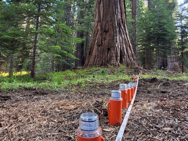
Miniaturised nodes enable easy and rapid deployment even in constrained or noisy environments.
5. Support CO₂ and Environmental Analysis
Seismic can support environmental researchers by:
-
Monitoring CO₂ storage, leakage pathways, and plume migration
-
Detecting changes in soil saturation, compaction, or gas movement
-
Assessing impacts of drought, land use, and vegetation change
Time-lapse monitoring using small, affordable seismic systems like STRYDE makes repeated surveys feasible.
6. Drive Better Multi-Disciplinary Models
By integrating seismic data with hydrological, geochemical, and ecological datasets, researchers can:
-
Build more accurate critical zone models
-
Validate weathering, flow, and erosion predictions
-
Improve understanding of how surface processes influence subsurface structure
High-resolution seismic gives the physical context needed to connect biological and chemical observations to real subsurface geometry.
Why STRYDE is a game-changer for researchers:
For critical zone research, STRYDE’s seismic systems offer unique advantages:
-
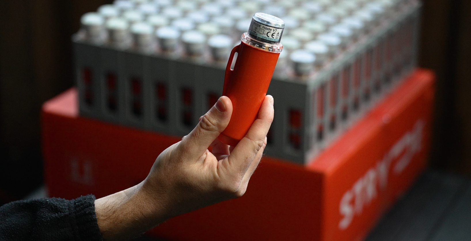
World’s most affordable nodes → large arrays now feasible on research budgets
-
Ultra-lightweight → easy deployment in forests, mountains, agricultural sites, or urban areas
-
High-trace-density capability → reveals fine-scale structure other systems blur out
-
Active + passive capability → one system, many applications
-
Lower logistical footprint → minimal impact on sensitive environments