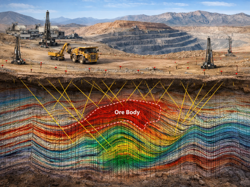
Reduce geological uncertainty with precise geological models powered by reflection seismic
Reflection seismic is one of the most powerful geophysical methods for high-resolution subsurface imaging in mineral exploration.
While the oil and gas industry has long relied on seismic data to locate hydrocarbons, optimise drilling, and reduce geological risk, the mining sector has historically faced barriers to adoption due to high acquisition costs and operational complexity.
With the latest modern reflection seismic data acquisition systems like STRYDE’s, high-density seismic is now affordable and practical for mining projects. Exploration teams can generate detailed geological models, reduce uncertainty, improve drill targeting, and avoid unproductive drilling.
By making seismic accessible at scale, STRYDE helps mining companies de-risk projects and accelerate mineral discovery.

Sandfire
Kalahari Copper Belt Exploration, Botswana"Seismic data that was acquired during Q1 FY25 was processed, interpreted, and integrated into our 3D basin model during the period. This data has greatly increased our knowledge of the basin architecture and has identified several near surface target areas, which are expected to be drilled during H2 FY25."
Reflection seismic is the only geophysical method capable of maintaining resolution at increasing depths and across large survey scales.
Discover how STRYDE’s solutions have been successfully deployed on more than 70 mineral exploration projects worldwide - hear directly from STRYDE’s Nick Tranter.
Testimonial:
"Thanks to STRYDE nodes, we were able to significantly reduce the project timeline and costs, allowing our client to quadruple the size of their survey.
The survey was completed quickly with a small crew and with minimal environmental disturbance. The high-quality data we acquired perfectly met our client's needs, enabling them to de-risk their coal developments and we couldn't be happier with the results!"

Brendon Mitchell
Managing Director, Oceania Geo


At STRYDE, we understand the budgetary and resource constraints the mining industry faces when integrating seismic data into the exploration process. That’s why we’ve developed tailored solutions to deliver decision-making-ready seismic data for our mining customers.
From comprehensive survey design and cost-effective seismic acquisition to fast-track imaging and interpretation, we provide affordable, high-quality 2D and 3D seismic data.
2D reflection seismic provides continuous depth imaging and full prospect coverage - far beyond the point data delivered by drilling alone.
By revealing the broader geological framework, including faults, lithological contacts, shear zones and mineralised bodies at depth, seismic enables more accurate geological models and better drill targeting.
The result: reduced geological uncertainty, higher-probability drilling, and a stronger, more defensible exploration case for investors.
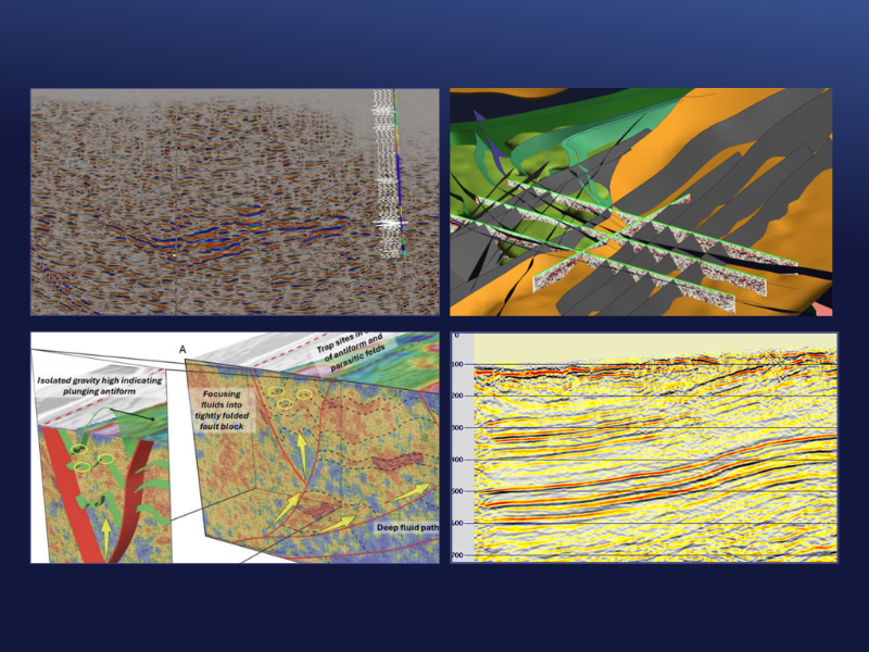
Image reference: Seismic data from Survey Line 2, highlighting the Manta seismic reflector and MAD213 drill hole pegmatite intercepts- acquired by STRYDE nodes for St George Mining Limited

3D reflection seismic enables precise drill target identification for exploration and mine expansion projects.
By delivering affordable, high-resolution 3D seismic cubes, STRYDE makes advanced subsurface imaging accessible to both junior explorers and major mining operators.
The result: fewer unnecessary boreholes, more efficient resource delineation, and significantly reduced exploration risk.
Image reference: Isometric view of the Long South Gap prospect area illustrating location of northern seismic line, key initial litho- structural interpretation together with possible channel feature (yellow ellipse) - acquired by STRYDE nodes for Lunnon Metals Limited

Our technology unlocks the ability to conduct mining exploration at depths beyond which surface drilling is prohibitively expensive. STRYDE offers the most affordable seismic node on the market today, allowing companies to save significant costs when it comes to equipment leasing or purchasing.
Unlike bulky nodes and cable-based systems, thousands of STRYDE Nodes™ can be air-freighted to virtually any location and transported easily in small vehicles. This opens up the possibility of conducting seismic operations in remote or unconventional locations, whether that be in mountainous terrain or desert environments.
By coupling our advanced nodal technology, efficient field operation and our fast-track data processing solutions, we are able to quickly deliver interpretation ready seismic data to our clients, meaning critical decisions can be made faster than ever before.
By making the deployment of high-channel counts needed for high-trace density data an affordable option, we can generate better quality subsurface images to de-risk decision making further.

The STRYDE Node™ is the smallest and most cost-effective seismic recording device on the market today.
Weighing a mere 150g, this advanced seismic technology offers the most affordable and practical means to collect high-quality seismic data essential for geologists to make informed decisions.
Discover how companies operating throughout the mining industry have benefitted from STRYDE’s revolutionary nodal technology.
In September 2025, the Geological Survey of Finland (GTK) commissioned Geopartner Geofizyka, equipped with the STRYDE Nimble Seismic System, to acquire regional-scale reflection seismic data to support their mineral system prospectivity studies in Finland.
Learn more

The data revealed rich and strong reflectivity associated with the intrusion as calibrated by the Koillismaa deep drill hole, which reached ultramafic rocks (pyroxenite, peridotite) at 1.4 km depth. Significant along-strike changes are also observed with more pronounced reflectivity present west of the Koillismaa drillhole.
Learn more

Iceni Gold Limited reported that 2D seismic acquired by STRYDE's nodes played a significant role in this project, by producing the geological model forming the seismic interpretation deliverable product.
Learn more

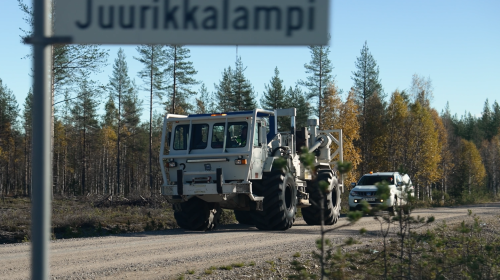
A new 70-km long reflection seismic profile was acquired across the Palaeoproterozoic Peräpohja belt in northern Finland to shed new light on its structural framework. Single-receiver and single-source acquisition was implemented, resulting in excellent data quality. Survey layout was optimized for the ability to extract 3D reflector orientations as constraints for the 3D geological model. Initial seismic processing results reveals rich and coherent reflectivity in the top 15 km of the crust.
Learn more

This presentation shows how velocity models derived from first-break refraction tomography for one particular high-density survey assist in the 3D mapping of the overburden/bedrock contact of a magmatic intrusion and provide extra detail to the extent of the low-velocity ore bodies beneath
Learn more

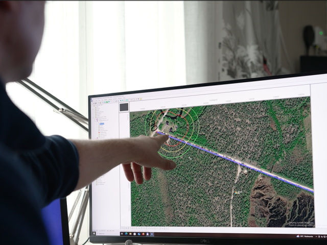
During this survey STRYDE's nodes were used to acquire 62 kilometres of active 2D reflection seismic and the overlapping 100 square kilometres of passive seismic data.
Learn more

STRYDE's seismic technology was used by Oceania Geo and Total Seismic to gather 2D seismic data which was crucial in allowing their customer to delineate coal resources and mitigate risks for future mining operations in Queensland.
Learn more

Discover how STRYDE's seismic sensors were used to acquire high-resolution seismic data required for mining exploration.
Learn more

Explor approached STRYDE to trial our STRYDE Nimble system™️ in conjunction with their innovative Pinpoint® seismic source for a mining client.
Learn more