E. Kleiss, A. Vondrak, E. Van der Voet, B. Turner and R. De Kunder
This paper presents the results of two small, target-oriented sparse seismic surveys conducted to support the planning and optimisation of geothermal doublets.
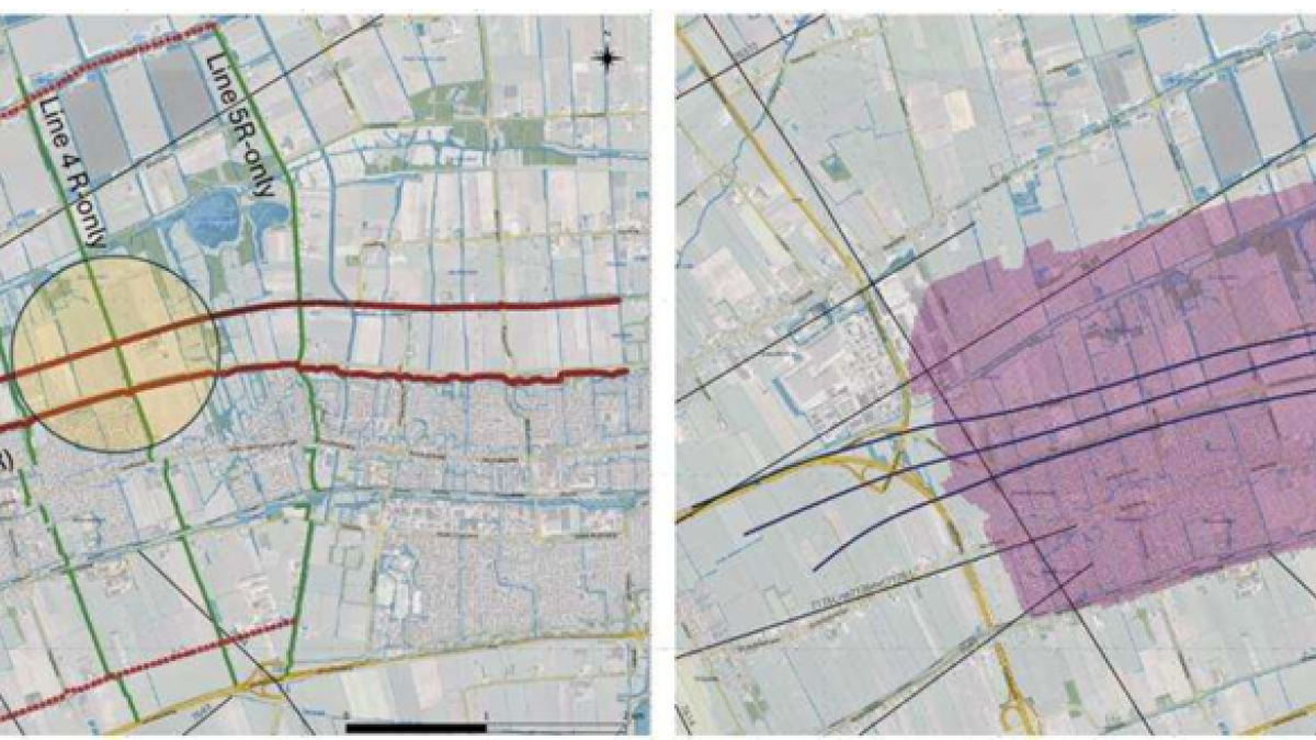
The surveys combine short conventional 2D seismic lines with 3D cross-spreads created by orthogonal 2D line layouts. This acquisition strategy provides a reliable areal image of the subsurface within a focused area of interest while maintaining a relatively low survey footprint.
Data was acquired using low-power electromagnetic vibrators and STRYDE nodal sensors, enabling seismic operations in a complex mixed urban, industrial, and agricultural environment.
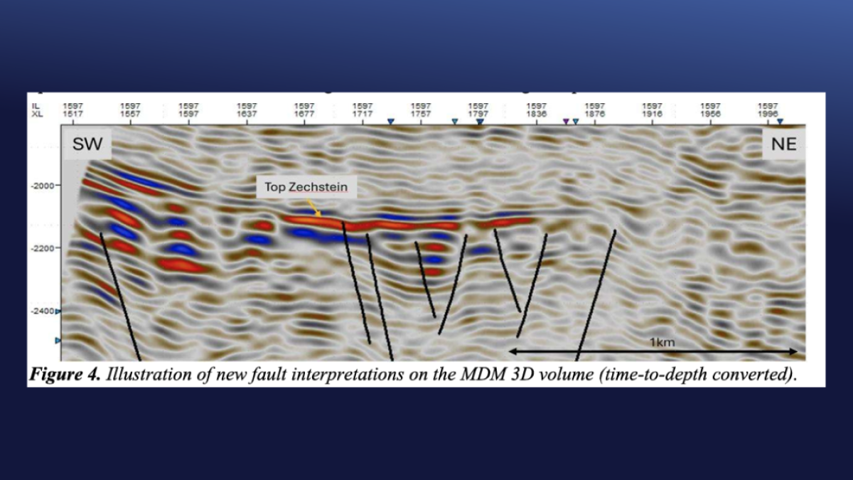
Despite high ambient noise levels, limited access, and the use of low-energy sources, the surveys successfully imaged subsurface targets at depths of 2000–2500 m below mean sea level. The results delivered valuable additional subsurface insights for the operator, particularly improving the understanding of small-scale faults and fault patterns within the geothermal development blocks.
Technical paper
Swiss Geo Energy: Unlocking Geothermal Potential through 3D Seismic
Read technical paperTechnical paper
Seismic Node Arrays for Enhanced Understanding and Monitoring of Geothermal Systems
Read technical paperTechnical paper
Acquiring sustainable, efficient high-resolution seismic data for geothermal exploration in an urban environment
Read technical paperTechnical paper
Large-N seismic node networks for monitoring seismicity and crustal stress-state at geothermal systems
Read technical paper