
Onshore Exploration Targeting Service
Powered by STRYDE and Getech, this fully integrated geophysical solution enables companies to explore, evaluate, and model subterranean resources and carbon storage potential. It delivers decision-ready subsurface intelligence that reduces uncertainty and guides smarter, more targeted exploration investment.
Introducing a powerful exploration pathway solution from Getech and STRYDE, designed to help industries like oil and gas, mining, hydrogen, CCUS, and geothermal, de-risk the exploration cycle with existing geoscience data and subsurface expertise.
Already deployed successfully on multiple projects, the service has demonstrated its value as a powerful end-to-end subsurface targeting solution for optimising exploration investment and maximising project return.
Enabling early screening and pinpointing of high-value prospects, we help our customers accelerate exploration, optimise seismic survey design, and cut unnecessary subsurface data acquisition costs - delivering focused, drill-ready insights for informed investment decisions.
Quickly identify and prioritise high-potential exploration areas by accessing Getech’s global knowledge, gravity and magnetic database for efficient regional scouting and target high-grading.
By understanding where subsurface prospectivity is highest, you can optimise survey location and design parameters to achieve the highest-quality subsurface insights and accelerate the path to discovery.
Reduce exploration costs by eliminating unnecessary surveying and lowering risk by directing investment toward areas with proven geological potential - maximising your budget and increasing the likelihood of discovery.
We integrate multiple geoscience datasets, including gravity, magnetic, legacy/new seismic, well, and geological data, into a cohesive subsurface model to help you make investment decisions with confidence.


Max Brouwers
Chief Business Development Officer“The market has long lacked a streamlined, data-driven service that connects early lead identification to the delivery of direct targets.
We are thrilled to collaborate with another industry leader to bring this unique solution to market.
Our partnership with STRYDE combines Getech’s expertise in basin evaluation and geoscience intelligence with STRYDE’s specialism in nodal seismic acquisition for high-resolution subsurface imaging, creating a powerful service that accelerates the discovery process for energy and mineral companies.
By integrating multiple geophysical datasets with expert interpretation, this new service empowers customers to target smarter, spend less, and discover more.”

Cameron Grant
Chief Commercial Officer"At STRYDE, we collaborate closely with the end-users of the geophysical data that our technology is used to acquire, helping them optimise survey design parameters to achieve the highest-quality subsurface insights.
Through these discussions, we often uncover two key challenges: limited internal expertise in the regional exploration challenges and a lack of insight into where to focus exploration efforts for the most ROI. Many operators rely on large, sparse surveys when they could achieve better results with targeted, high-density 3D seismic, once leads and targets are more clearly defined through existing data and analysis. Our new service delivers the intelligence needed to enable operators to make more precise, data-driven decisions."
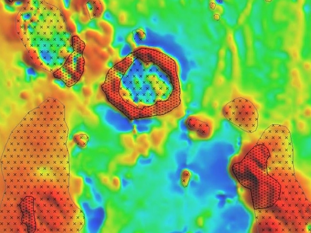
A recent regional and multiphase project in the Middle East, showcased the full value of this new exploration pathway service. Getech began by analysing gravity and magnetic data to map subsurface density and susceptibility contrasts. These datasets are particularly well-suited for identifying localised geological features such as positive structures, sub-basins, and depocentres.
This analysis provided critical insight into the depth and extent of the petroleum system and helped pinpoint areas with the highest prospectivity. Deliverables included enhanced gravity and magnetic maps, a structural interpretation, reinterpretation of legacy seismic data, detailed lead descriptions, and a comprehensive lead summary map.
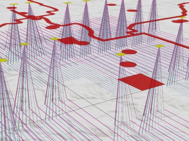
Based on these findings, a targeted 3D seismic acquisition campaign was recommended in high-value zones. STRYDE then designed and planned the seismic programme to ensure an efficient acquisition process focused precisely where new data will deliver the greatest impact for decision-making.
Eight steps to faster, better onshore energy, storage, and mineral exploration.

Collaborate with the customer to define exploration objectives and establish key project milestones, ensuring alignment with strategic goals.
Conduct high-level subsurface screening using global gravity, magnetic, and geological datasets to create a comprehensive understanding of basin structure and potential.

Assess hydrocarbon or mineral potential through structural, stratigraphic, and geophysical analysis to support portfolio management and acreage prioritisation.

Map the geographic extent of prospective plays and evaluate geological risks to identify low-risk zones and prioritise detailed studies.

Generate and assess leads and prospects using refined geological models; develop a ranked portfolio and determine optimal seismic acquisition zones.

Design and manage seismic surveys to maximise data quality, trace density, and cost-efficiency - enabling confident drilling decisions.

Integrate all relevant geoscience information to generate deep insight into the subsurface potential for targeted resource exploration.
Translate the subsurface insight into a prioritized and de-risked portfolio with clear business recommendations and actionable plans.