
Case study
To support hydrocarbon exploration, a Polish oil and gas operator commissioned Geopartner Geofizyka to conduct a 3D seismic survey to generate a high-resolution image of the subsurface.
Onshore Poland
Farmland, villages, and towns
300 sq. km
The STRYDE Nimble System
Vibroseis
23,000
Meet the STRYDE Nimble Seismic System - helping seismic crews move faster and acquire better seismic data, for less.
“Since 2022, we have successfully acquired high-resolution seismic data for multiple clients across Europe using the STRYDE Nimble Seismic System.
For this project, it was an easy decision to expand our STRYDE inventory to acquire seismic across such a vast area of land, not only because the system is cost-effective, but because our clients are consistently impressed with the quality of the seismic deliverables and the speed at which data can be made available.
We’ve experienced first-hand the remarkable impact of STRYDE’s technology, but what truly sets them apart is their team. The expertise, adaptability, and determination demonstrated by STRYDE consistently exceeds our expectations.
We’re excited to continue our partnership with them on upcoming projects, confident that their solutions will once again deliver exceptional results."

Jacek Słowiński
CEO, Geopartner Geofizyka

| The survey area spanned extensive farmland, requiring Geopartner Geofizyka to negotiate access with hundreds of landowners - a time-consuming and delicate process. |
|---|
| Limited funding demanded a cost-effective seismic solution capable of delivering high-quality data without exceeding budgets. |
|---|
| The 300 km² survey had to be completed within a strict timeframe to meet exploration licence obligations and prevent block forfeiture. |
|---|
| Poor road access and muddy terrain restricted vehicle movement, forcing the team to hand-carry equipment across difficult terrain. |
|---|
| Active farming operations and unpredictable weather required real-time adjustments to deployment plans. |
|---|
| The survey spanned farmland, towns, highways, rivers, and railways, requiring careful planning for safe and efficient operations. |
|---|
| STRYDE’s compact, cable-free and lightweight nodes drastically reduce the manpower and logistics needed for deployment and retrieval, minimising local disruption and enabling operations around complex surface infrastructure. |
|---|
| STRYDE is the lowest-cost seismic acquisition system on the market and its lightweight form factor enables contractors to cut crew size and logistics costs by up to 50% compared to conventional systems. |
|---|
| With STRYDE’s scalable ecosystem and streamlined workflows, small and agile teams can deploy and harvest thousands of nodes in record time, maintaining momentum and efficiency across vast survey areas. |
|---|
| Weighing just 150g per node, STRYDE’s ultra-lightweight design and ergonomic deployment backpacks (holding 90 nodes per person) enable teams to deploy and retrieve by foot, even in waterlogged or inaccessible areas. |
|---|
| STRYDE’s navigation software supports in-field offsetting, allowing autonomous teams to adjust node positioning without compromising geometry or data integrity. |
|---|
| STRYDE’s small, wireless design allows seamless and safe data acquisition across mixed terrain and congested zones. |
|---|
| The ability to conduct low-impact and discreet operations eased negotiations, built trust with farmers, and streamlined land access approvals. |
|---|
| By cutting equipment, manpower, and logistics costs, Geopartner Geofizyka successfully delivered a high-quality seismic survey with significantly lower overall expenditure. |
|---|
| The project was completed on schedule without compromising data quality or operational safety. |
|---|
| Deployment targets were achieved efficiently, reducing environmental emissions and maintaining the survey schedule. |
|---|
| Crews maintained productivity and data quality while minimising downtime despite rapidly changing conditions. |
|---|
| Lightweight nodes reduced HSE risks and enabled efficient, continuous operations in areas where traditional systems couldn’t operate effectively. |
|---|
| Challenge | How STRYDE helps overcome this challenge | The impact this had for Geopartner Geofizyka | |
|---|---|---|---|
| Land access | The survey area spanned extensive farmland, requiring Geopartner Geofizyka to negotiate access with hundreds of landowners - a time-consuming and delicate process. | STRYDE’s compact, cable-free and lightweight nodes drastically reduce the manpower and logistics needed for deployment and retrieval, minimising local disruption and enabling operations around complex surface infrastructure. | The ability to conduct low-impact and discreet operations eased negotiations, built trust with farmers, and streamlined land access approvals. |
| Cost constraints | Limited funding demanded a cost-effective seismic solution capable of delivering high-quality data without exceeding budgets. | STRYDE is the lowest-cost seismic acquisition system on the market and its lightweight form factor enables contractors to cut crew size and logistics costs by up to 50% compared to conventional systems. | By cutting equipment, manpower, and logistics costs, Geopartner Geofizyka successfully delivered a high-quality seismic survey with significantly lower overall expenditure. |
| Tight turnaround time | The 300 km² survey had to be completed within a strict timeframe to meet exploration licence obligations and prevent block forfeiture. | With STRYDE’s scalable ecosystem and streamlined workflows, small and agile teams can deploy and harvest thousands of nodes in record time, maintaining momentum and efficiency across vast survey areas. | The project was completed on schedule without compromising data quality or operational safety. |
| Limited deployment routes | Poor road access and muddy terrain restricted vehicle movement, forcing the team to hand-carry equipment across difficult terrain. | Weighing just 150g per node, STRYDE’s ultra-lightweight design and ergonomic deployment backpacks (holding 90 nodes per person) enable teams to deploy and retrieve by foot, even in waterlogged or inaccessible areas. | Deployment targets were achieved efficiently, reducing environmental emissions and maintaining the survey schedule. |
| Challenging environment | Active farming operations and unpredictable weather required real-time adjustments to deployment plans. | STRYDE’s navigation software supports in-field offsetting, allowing autonomous teams to adjust node positioning without compromising geometry or data integrity. | Crews maintained productivity and data quality while minimising downtime despite rapidly changing conditions. |
| Large and complex survey area | The survey spanned farmland, towns, highways, rivers, and railways, requiring careful planning for safe and efficient operations. | STRYDE’s small, wireless design allows seamless and safe data acquisition across mixed terrain and congested zones. | Lightweight nodes reduced HSE risks and enabled efficient, continuous operations in areas where traditional systems couldn’t operate effectively. |
This fully integrated seismic acquisition system is a rapid-deploy, plug-and-record solution that empowers crews to acquire high-density data in record time.
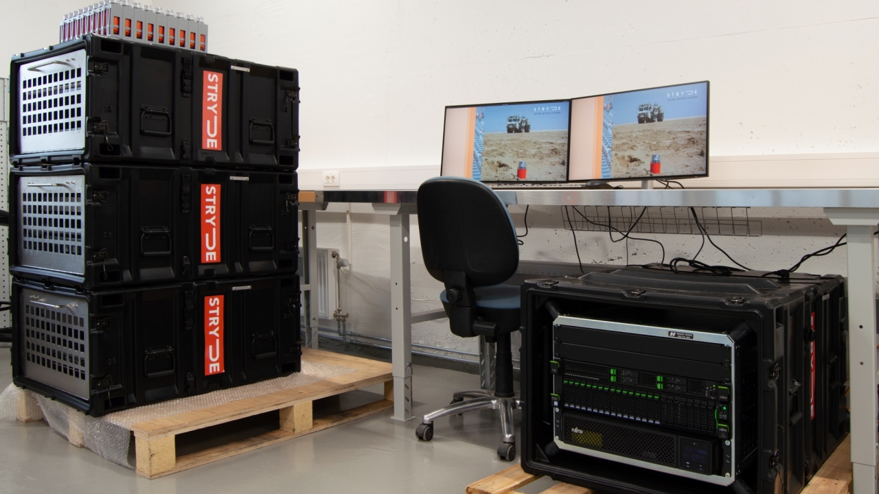
the most powerful node ecosystem available in the industry today
up to 6 charge and harvesting nests can be attached to the system
allowing 3,240 nodes to be charged and harvested in 24 hours
with only 1 operator required for node recording operations