
Case study
NGI deploys it's STRYDE Range+ nodes and Mini Seismic System for a road development project in Norway
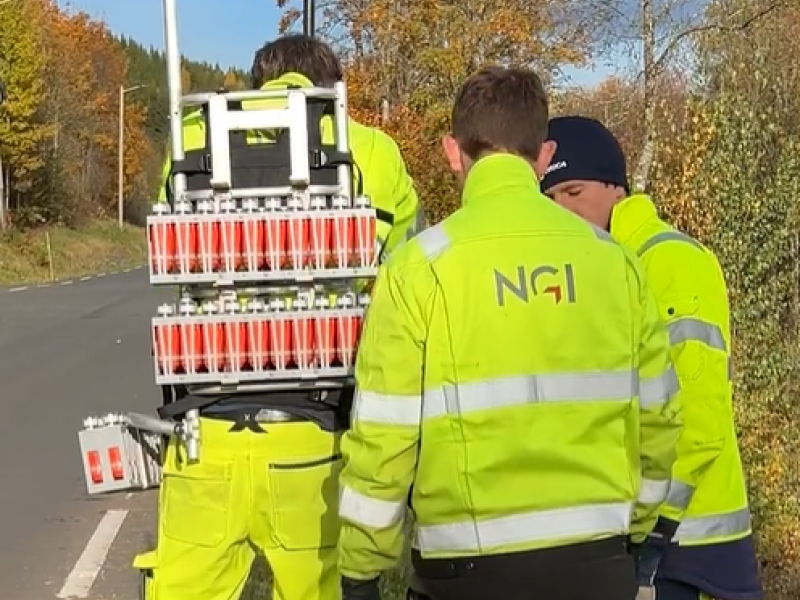
In October 2025, the Norwegian Geotechnical Institute (NGI) utilized their newly acquired STRYDE Range+ nodes and Mini Seismic System to conduct a high-resolution seismic survey for a major road infrastructure improvement project in Norway. The survey aimed to map the depth to bedrock and evaluate subsurface rock quality at a site being assessed for the feasibility of constructing an underground tunnel.
The seismic data acquired using STRYDE’s advanced nodal technology will be processed to generate detailed insights into the subsurface conditions. These results will play a crucial role in supporting geotechnical decision-making and shaping engineering strategies for the development of National Road 4 - a vital northbound transport corridor connecting Oslo to Norway’s interior.
By integrating STRYDE’s lightweight and efficient seismic systems, NGI is enhancing the accuracy and cost-effectiveness of geophysical investigations that underpin critical national infrastructure projects.
STRYDE’s seismic technology is transforming how geotechnical and civil engineering teams investigate the subsurface - delivering faster deployments, reduced survey costs, and superior data quality for projects such as tunnel feasibility studies, road expansions, and urban infrastructure planning.
The STRYDE Mini System is a complete nodal seismic system designed to enable land seismic projects requiring up to 1,500 channels.
Ideal for small-scale seismic surveys and research projects, this system can be used with any source type including weight drop, dynamite and vibroseis, or for passive seismic acquisition.
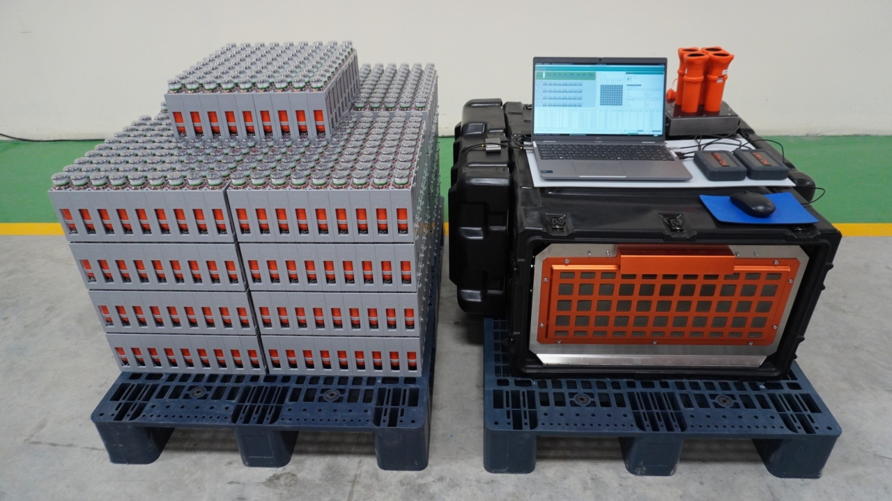
The world's smallest and most affordable nodes
High-capacity node charging and data download rack
Software for survey planning, node and data management
Efficient and ergonomic node deployment and retrieval