
The Definitive Guide
Challenges, Technologies & Future Trends

MENA is one of the world’s most active and demanding land seismic markets, defined by vast desert environments, large-scale surveys, and some of the highest channel counts deployed globally. Land seismic remains central to exploration, appraisal, and field redevelopment across the region, driven largely by National Oil Companies (NOCs) operating long-cycle, technically rigorous programmes.
Today, MENA seismic projects face increasing pressure to deliver higher-resolution data while simultaneously reducing HSE exposure, minimising environmental impact, and executing faster with optimized crews. These demands are reshaping how land seismic acquisition is designed and delivered across the region.
This hub brings together expert insight, real-world experience, and regional knowledge to explore the challenges, technologies, and trends defining land seismic acquisition in MENA.
Complex carbonate geology, fractured reservoirs, and highly variable near-surface conditions complicate seismic imaging. Combined with the challenges of desert terrains, these factors place a premium on acquisition designs that deliver consistent sampling, robust signal quality, and reliable subsurface characterisation at scale.
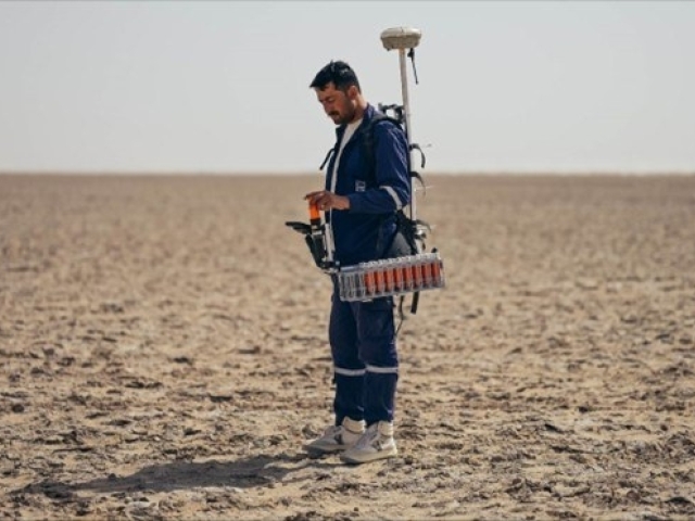
Extreme temperatures, remote and logistically complex locations, and highly variable surface conditions such as sand, dunes, and hard sabkha are challenges often compounded by access restrictions and land-use sensitivities, requiring acquisition approaches that prioritise safety, reliability, and operational efficiency without compromising data quality.
Health, safety, and environmental performance is a critical driver in MENA land seismic projects, where large crews, equipment management and remote operations significantly increase operational risk. Reducing crew exposure, limiting vehicle movements, and minimising manual handling are central to modern acquisition strategies, particularly on large-scale surveys where small efficiency gains translate into meaningful HSE improvements.
Environmental considerations are increasingly influencing how land seismic surveys are designed and executed across desert terrains. Operators are placing greater emphasis on reducing line clearing, minimising ground disturbance, and limiting physical equipment in the field, driving demand for acquisition approaches that achieve high data quality with a lighter environmental footprint.
Increasing pressure to deliver faster and more accurate subsurface imaging to support exploration, appraisal, and field redevelopment decisions. As targets become more subtle and geological complexity increases, seismic acquisition must provide higher-resolution data without extending project timelines, reinforcing the need for approaches that improve imaging quality while maintaining operational efficiency at scale.
Survey cost remains a critical consideration for land seismic acquisition in the MENA region, particularly on large-scale projects where logistics, manpower, and equipment volumes quickly drive total expenditure. Operators are increasingly focused on reducing total cost of ownership by improving deployment efficiency, limiting field complexity, and accelerating acquisition schedules—without compromising data quality or HSE performance
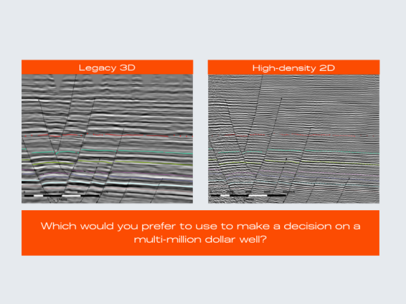
High-density seismic acquisition plays a critical role in improving subsurface imaging by increasing spatial sampling, fold, and azimuthal coverage.
Finer receiver and source spacing reduces spatial aliasing, enhances signal-to-noise ratio, and enables more effective statics, noise attenuation, and velocity model building.
This is particularly important in complex geological settings, like the MENA region, where improved sampling directly translates into better imaging of fractures, subtle stratigraphic features, and reservoir-scale heterogeneity.
The days of heavy, expensive, and maintenance-intensive cabled geophones are fading.
Modern oil and gas operators are increasingly leveraging nodal seismic technology for land seismic acquisition - enabling acquisition to be simpler, more cost-effective, and less invasive than ever before - while preserving image quality with data proven to be comparable to traditional cabled systems.
"CCED has recently acquired the world’s largest 3D node survey over our blocks 3 & 4 (29, 219 sqkm), onshore Oman.
This nodal technology approach (c.165,000 channels) provides multiple benefits to CCED, by cutting down on data acquisition costs, minimizing HSE footprints in the field (less manual handling, reducing vehicle count from c.160 to c.40, reduced field crew size 600 to c.220 etc.), and expanded land access in our sabkha-dune environment, all to acquire high quality, operationally efficient (high density, point receiver geometries providing increased spatial sampling density, with no compromise to data quality) outcomes."
Exploration and Appraisal Director, CCED
Delivering better seismic data at lower cost requires a fundamental shift in how land surveys are designed and executed.
Nodal seismic has become the preferred acquisition model for many leading companies, enabling higher channel counts, simpler field operations, and reduced HSE and environmental exposure.
However - choosing the right nodal technology is a key success factor in removing the traditional cost and complexity barriers, making high-quality, large-scale nodal seismic acquisition achievable at a fundamentally lower cost.
- Heavier node hardware increases manual handling and HSE exposure
- Larger batteries and unnecessary features add weight, logistics complexity, and transport costs and risk
- Deployment and retrieval can be slower on large, high-channel-count surveys
- Higher total cost of ownership limits economic scalability
- Operational complexity increases crew size and field footprint
- Recording operations in camp are slower due to low-capacity ecosystems
- Nodes deployed on the surface are more susceptible to ambient noise, theft or interference, and can restrict source movement and operational flexibility
- Ultra-lightweight nodes significantly reduce manual handling and HSE risk
- Optimized battery and elimination of unnecessary functionality reduces equipment weight, simplifies crew logistics and reduces transport costs
- Fast, simple deployment and retrieval enables higher productivity
- Lower total cost of ownership makes high-density, large-scale acquisition economically viable
- Proven data quality suitable for high-resolution land seismic imaging
- Recording operations in camp are significantly faster thanks to high-capacity ecosystems
- Easy to bury nodes reduces ambient noise, limits the risk of interference or theft, and removes obstacles that can constrain source operations.
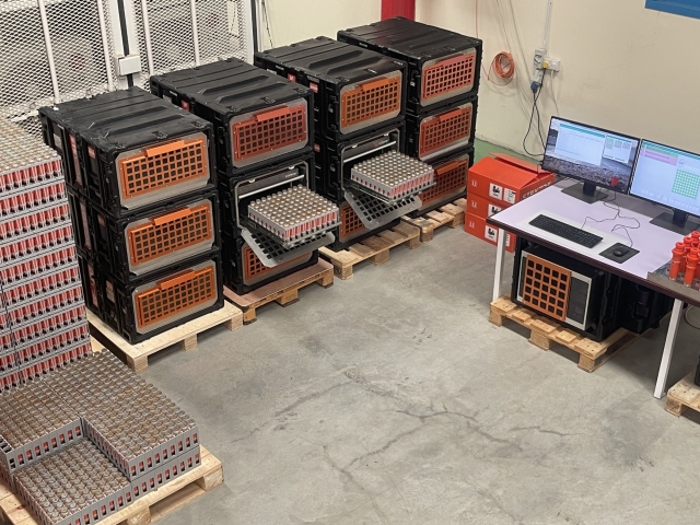
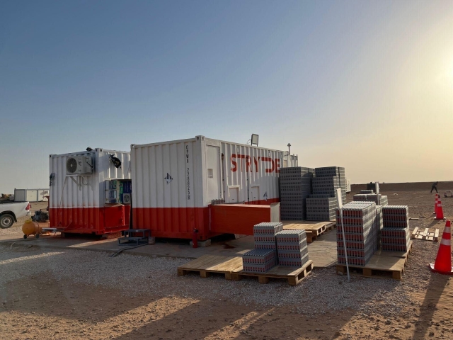
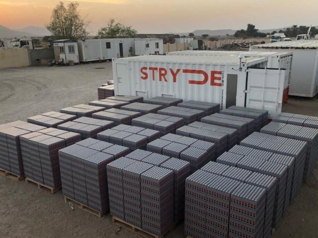
STRYDE is redefining large-scale land seismic acquisition by combining proven nodal technology with three fully developed node ecosystems.
With over one million nodes delivered to market and more than 380 surveys completed across 65 countries, STRYDE’s technology is trusted globally to deliver reliable, high-quality seismic data at scale.
At the core is a lightweight, field-proven node designed for efficiency, safety, and performance, supported by an end-to-end ecosystem that includes deployment workflows, high-capacity harvesting hardware, QC and data storage. Together, this enables truly scalable seismic acquisition - designed to meet the operational, technical, and economic demands of modern land seismic projects, including those across the MENA region.


Learn more →

Learn more →
Learn more →
Learn more →

Learn more →

Learn more →

Learn more →
Learn more →