
Case study
Discover how Geomega delivered highly effective shallow-subsurface imaging and detailed mapping of the topmost geological layers in a former Hungarian mining area, enabling planners to make confident, informed decisions for future infrastructure development.
The Nyírád–Deákipuszta region in Hungary, located on the western edge of the Bakony Mountains, a previous active bauxite mining hub.
Historical underground operations included significant groundwater lowering, and once mining ceased, the natural rebound of groundwater levels triggered the collapse of several mined blocks and the onset of surface deformation.
Ongoing surface movements continued to pose significant risks, making precise geotechnical information essential for future land-use and infrastructure planning. Accurate mapping of the shallow geology was therefore critical to assess residual deformation resulting from historical mining activities.
A combination of high-resolution 2D P-wave and S-wave seismic surveys were conducted across the former mining block. Building on the success of the 2D campaign, a 3D S-wave seismic survey was then deployed over a priority zone earmarked for future construction.
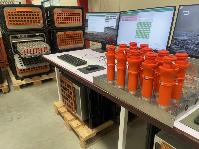
2,420 ultra-lightweight STRYDE seismic nodes and Nimble recording system.
Seismic Mechatronics' Lightning eVibe source.
Geomega acquired nine inline sections, each approximately 300 m in length, and four crossline sections, each approximately 240 m in length. Sensors were deployed at 3 m spacing. At each measurement point, two STRYDE nodes were positioned -one oriented perpendicular and one parallel to the survey line -to record 2-component (2C) data. In total, the survey utilised 1,210 measurement points.
The results revealed that localized undermining had caused notable ground subsidence and loosening of near-surface layers in several parts of the survey area, whereas other zones remained completely undisturbed in terms of lithology and geotechnical integrity. Based on these findings, the undisturbed sections were selected as the preferred locations for the planned construction activities.
"Seismic mapping of the topmost layers were completed very effectively using Lightning eVibe source and STRYDE receivers for S-wave recording.
Preliminary 3D results reveal rich tectonic and sedimentary detail, while importantly showing no signs of additional subsurface deformation linked to historical mining activities.
These findings provide confidence for planners and developers as they progress with future infrastructure projects in the region."
Gabor Kovacs
GIS Expert at Geomega


At STRYDE, our mission is to make high-density seismic data affordable to anyone. High-density data is the foundation of high-resolution seismic imaging - but achieving it on land often means balancing cost, logistics, and terrain challenges.
STRYDE’s Nimble Seismic System redefines that balance. Our lightweight nodal technology, modular harvesting hardware, and semi-automated handling solutions enable faster, safer, and more efficient surveys -cutting costs, reducing crew size, and accelerating data delivery.
Designed for speed and scalability, the system maximizes throughput across every stage of the seismic survey. From charging and programming, to deployment, recovery, and data offload - allowing you to increase data density and imaging quality without extending budgets or time in the field.