Case study
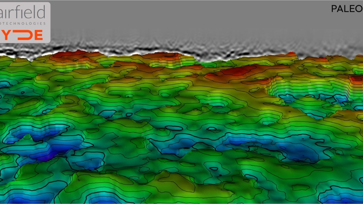
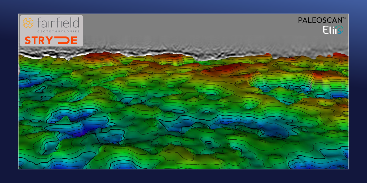
Using an array of more than 41,000 seismic receivers inside four square miles, Fairfield Geotechnologies embarked on a unique project in the Delaware Basin of New Mexico to better map unconventional reservoirs.
Imaging deep reservoirs in a complicated shallow overburden setting can be challenging. That’s what some operators in the Delaware Basin concluded in areas where the reservoirs lie beneath the Cenozoic sedimentary fill zone.
The reasons are numerous. Wavefield scattering between the different formations creates artefacts in the seismic data, and salt dissolution and subsequent collapse of the overlying rocks caused a significant vertical offset in the sedimentary strata.
It is that combination of factors that resulted in the seismic resolution in a large part of the Delaware Basin being insufficient to properly map the deeper unconventional reservoirs of the Bone Spring and Wolfcamp formations. This caused companies to give up on the idea of using seismic data to play a role in development plans.
It is against that backdrop that Fairfield Geotechnologies, supported by four operating companies in the Delaware Basin, ran a high-trace-density seismic acquisition campaign to prove that, with the right trace-density setup, imaging the shallow structural complexity of the Rustler formation, as seen in the foldout, improves the resolution of the reservoir beneath.
Read more about how this was achieved in the article, linked below.
Hear more from Bruce Karr and Andrew Lewis in this notably frank and insightful interview with STRYDE CEO Mike Popham, where they share valuable lessons and honest reflections from the field.
At STRYDE, our mission is to make high-density seismic data affordable to anyone. High-density data is the foundation of high-resolution seismic imaging - but achieving it on land often means balancing cost, logistics, and terrain challenges.
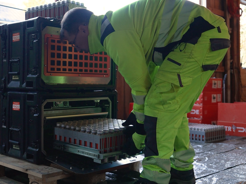
STRYDE’s Nimble Seismic System redefines that balance. Our lightweight nodal technology, modular harvesting hardware, and semi-automated handling solutions enable faster, safer, and more efficient surveys -cutting costs, reducing crew size, and accelerating data delivery.
Designed for speed and scalability, the system maximizes throughput across every stage of the seismic survey. From charging and programming, to deployment, recovery, and data offload - allowing you to increase data density and imaging quality without extending budgets or time in the field