The Definitive Guide
Challenges, Technologies & Future Trends

Latin America & the Caribbean (LAC) are rapidly evolving land seismic markets, characterised by diverse geological settings, emerging resource exploration programs, and expanding demand for high-resolution subsurface data.
Whether driven by hydrocarbon exploration, critical minerals demand, geothermal potential, or infrastructure and environmental studies, land seismic acquisition remains central to subsurface decision-making across the region.
Today’s regional seismic projects face increasing pressure to deliver better imaging at lower cost, while adapting to complex terrain, rising safety and environmental expectations, and growing expectations for data quality and turnaround - trends reshaping how land seismic acquisition is designed and delivered throughout LAC.
From the Andean foothills and Amazon basin to Caribbean islands and Central American highlands, LAC present highly variable near-surface conditions and complex tectonic settings that challenge seismic imaging. Diverse rock types, structural fabrics, and geological complexities influence wave propagation, requiring acquisition designs that deliver consistent sampling and robust data quality. In regions of active tectonics, seismic surveys also play a dual role, supporting both subsurface exploration and seismic hazard assessment.
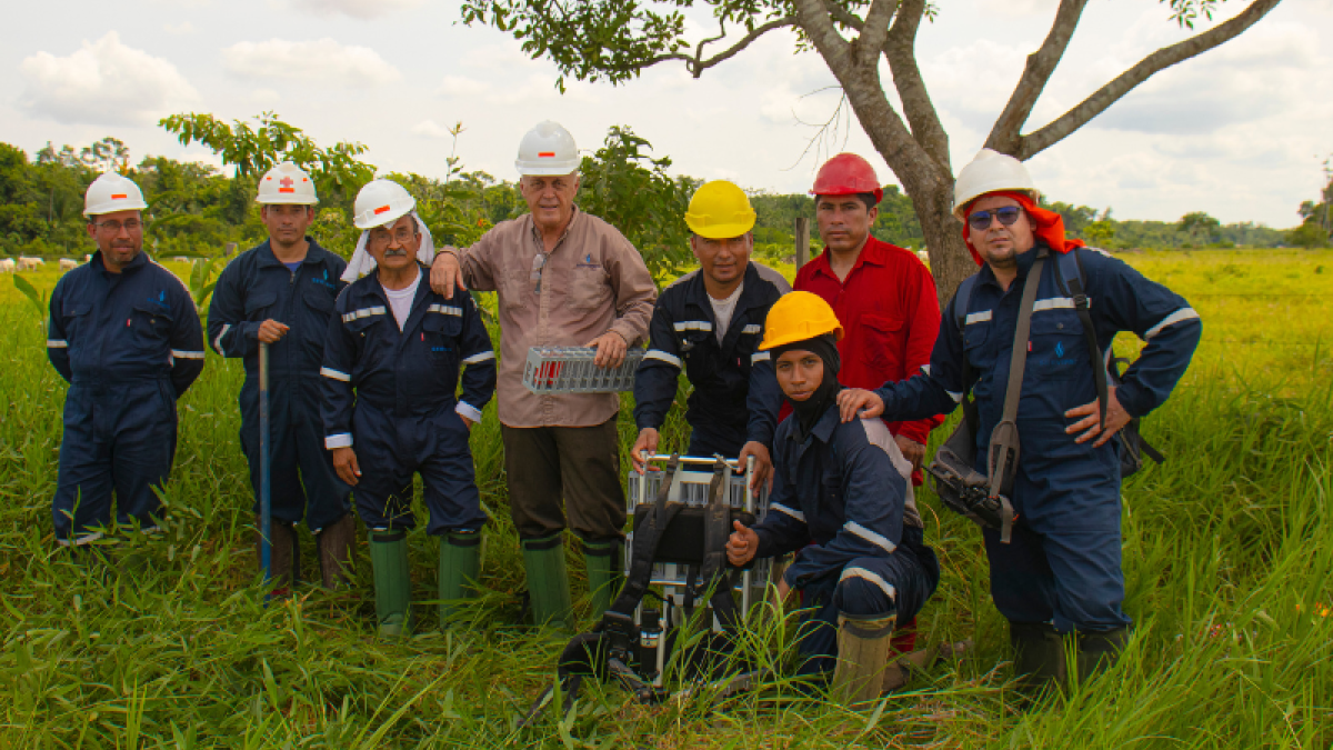
Seismic crews in LAC encounter dense vegetation, steep terrain, wetlands, and restricted access areas - from remote jungles to mountainous slopes. These conditions can slow mobilization, complicate logistics, and increase project risk if traditional acquisition methods are used. At the same time, operational windows may be limited by seasonal weather events such as tropical rainfall or hurricane patterns in Caribbean territories.
HSE performance is becoming a critical driver for stakeholders across the region. Larger crews, extensive equipment movement, helicoptorand manual handling in remote terrain increase safety risk and environmental exposure, especially when crews operate far from logistics hubs. Mining, hydrocarbons and infrastructure clients alike are seeking acquisition approaches that limit physical footprint and improve field safety
Environmental regulations and community engagement are increasingly shaping how surveys are planned and executed across LAC. Operators are placing greater emphasis on sustainability, minimizing clearance footprints, limiting vegetation disturbance, and integrating seismic surveys with local land-use plans to support social and environmental commitments.
Across LAC, the need to accelerate subsurface insight continues to grow. Exploration teams require higher-resolution seismic data to reduce drilling risk, while operators must balance cost efficiency with data quality to support faster decision-making. Together, these pressures are driving demand for acquisition solutions that improve imaging quality without extending operational timelines.
Total cost of ownership remains a core consideration, especially in emerging markets where budgets are constrained. Logistics, crew sizes, and equipment volumes can drive seismic project costs rapidly upward unless acquisition designs and technologies are selected with both efficiency and value in mind.
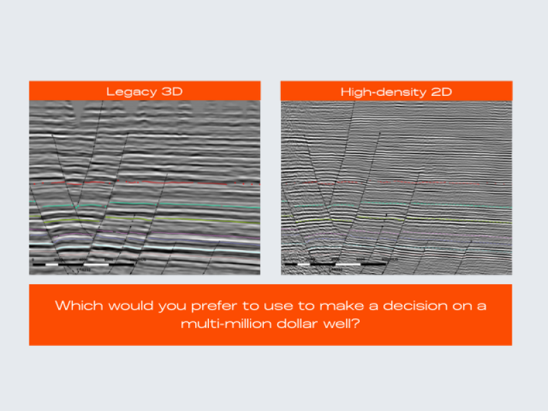
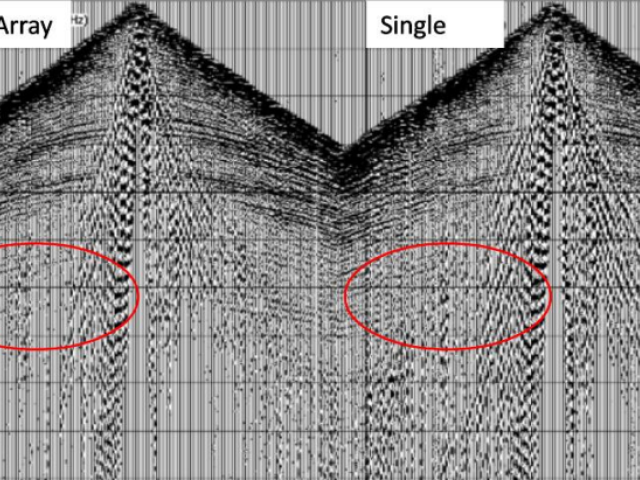
High-density seismic acquisition plays a critical role in improving subsurface imaging by increasing spatial sampling, fold, and azimuthal coverage.
Finer receiver and source spacing reduces spatial aliasing, enhances signal-to-noise ratio, and enables more effective statics, noise attenuation, and velocity model building.
This is particularly important in complex geological settings, like the LAC region, where improved sampling directly translates into better imaging of fractures, subtle stratigraphic features, and reservoir-scale heterogeneity
The days of heavy, expensive, and maintenance-intensive cabled geophones are fading.
Modern oil and gas operators are increasingly leveraging nodal seismic technology for land seismic acquisition - enabling acquisition to be simpler, more cost-effective, and less invasive than ever before - while preserving image quality with data proven to be comparable to traditional cabled systems.
"For this project, our customer required high-trace density seismic data across 85 km² of challenging terrain, including tropical rainforests, lakes, and wetlands, making STRYDE’s agile nodes a clear choice.
“Having used other nodal equipment for previous surveys, we are impressed with how STRYDE’s nodes are enabling denser and faster data collection, at the same cost as traditional sparser surveys. In a competitive market where the speed and accuracy of acquisition are critical to the success of exploration projects, this advancement is invaluable."
Delivering better seismic data at lower cost requires a fundamental shift in how land surveys are designed and executed.
Nodal seismic has become the preferred acquisition model for many leading companies, enabling higher channel counts, simpler field operations, and reduced HSE and environmental exposure.
However - choosing the right nodal technology is a key success factor in removing the traditional cost and complexity barriers, making high-quality, large-scale nodal seismic acquisition achievable at a fundamentally lower cost.
- Heavier node hardware increases manual handling and HSE exposure
- Larger batteries and unnecessary features add weight, logistics complexity, and air/road transport costs and risk
- Deployment and retrieval can be slower on large, high-channel-count surveys
- Higher total cost of ownership limits economic scalability
- Operational complexity increases crew size and field footprint
- Recording operations in camp are slower due to low-capacity ecosystems
- Nodes deployed on the surface are more susceptible to ambient noise, theft or interference, and can restrict source movement and operational flexibility
- Ultra-lightweight nodes significantly reduce manual handling and HSE risk
- Optimized battery and elimination of unnecessary functionality reduces equipment weight, simplifies crew logistics and reduces air/road transport costs
- Fast, simple deployment and retrieval enables higher productivity
- Lower total cost of ownership makes high-density, large-scale acquisition economically viable
- Proven data quality suitable for high-resolution land seismic imaging
- Recording operations in camp are significantly faster thanks to high-capacity ecosystems
- Easy to bury nodes reduces ambient noise, limits the risk of interference or theft, and removes obstacles that can constrain source operations.
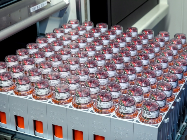
STRYDE is redefining large-scale land seismic acquisition by combining proven nodal technology with three fully developed node ecosystems.
With over one million nodes delivered to market and more than 380 surveys completed across 65 countries, STRYDE’s technology is trusted globally to deliver reliable, high-quality seismic data at scale.
At the core is a lightweight, field-proven node designed for efficiency, safety, and performance, supported by an end-to-end ecosystem that includes deployment workflows, high-capacity harvesting hardware, QC and data storage. Together, this enables truly scalable seismic acquisition - designed to meet the operational, technical, and economic demands of modern land seismic projects, including those across the LAC region.


Learn more →

Learn more →
Learn more →

Learn more →
Learn more →

Learn more →

Learn more →

Learn more →