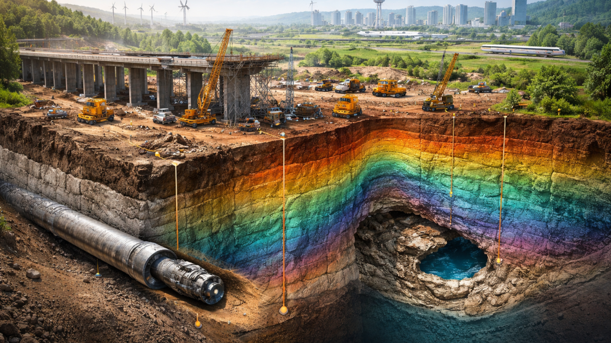
Advanced geotechnical investigations for infrastructure and civil works
Every onshore infrastructure project depends on one thing: knowing what’s below the surface.
Yet too many civil engineering projects still face unexpected ground conditions - from weak layers and buried channels to faulting, karst, voids, and variable rockhead - leading to:
High-resolution subsurface (seismic) imaging changes that. It gives you a fast, scalable way to understand the subsurface between boreholes and reduce uncertainty before you commit to design and construction.
A 3D S-wave high-resolution seismic survey to support safe infrastructure planning
Technical paper
A 3D S-wave high-resolution seismic survey to support safe infrastructure planning
Read technical paperSTRYDE nodes deployed for a civil engineering seismic survey in Norway
Imaging one of the largest Alpine slope instabilities with 3D seismic first-arrival traveltime tomography
Technical paper
Imaging one of the largest Alpine slope instabilities with 3D seismic first-arrival traveltime tomography
Read technical paperUltra-dense nodal seismic acquisition for automated geohazard analysis
Technical paper
Ultra-dense nodal seismic acquisition for automated geohazard analysis
Read technical paperVirginia Tech uses STRYDE technology to advance near-surface research
Traditional deep ground investigations are typically based on:
Boreholes
CPTs
Laboratory testing
These are critical, but they only provide point measurements.
Seismic enables continuous subsurface imaging over large areas - quickly and cost-effectively.
This helps engineering teams:
Identify risks early
Target boreholes more intelligently
Reduce uncertainty in ground models
Improve design confidence
Avoid expensive surprises during construction
Rockhead depth can change dramatically across short distances - especially in weathered sedimentary sequences, basalts, carbonates, or mixed lithologies.
Seismic helps map:
Rockhead depth
Weathering thickness
Competent rock zones
Weak transition layers
Example use cases:
Piled foundations for bridges and viaducts
Wind farm foundations
Large industrial slabs and heavy plant
Buried channels filled with soft sediments are a common cause of unexpected settlement, piling issues, and over-excavation.
Seismic helps identify:
Buried valleys
Lateral lithological changes
Soft sediment thickness
Hidden peat / clay pockets
Example use cases:
Highways and rail corridors
Airport expansions
Industrial access roads
Port and logistics hubs (onshore)
In carbonate terrains, karst is one of the highest-impact ground risks - and one of the easiest to miss with sparse boreholes.
Seismic helps identify:
Cavities and voids
Dissolution zones
Pinnacled rockhead
Collapse-prone ground
Example use cases:
Large buildings, commercial developments, energy facilities
Transport corridors
Water infrastructure
Seismic does not replace hydrogeology.
It can however provide strong insight into geological structures that control groundwater behaviour.
Seismic helps reveal:
Permeable channels
Faults and fracture zones
Layer continuity and aquifer geometry
Example use cases:
Dewatering strategy planning
Tunnelling and deep excavations
Flood defence projects
Faults and fractured zones can create:
Instability in excavations
Unexpected water ingress
Reduced bearing capacity
Rockfall risk
Seismic helps map:
Fault offsets
Fracture corridors
Zones of reduced stiffness
Discontinuities affecting slope stability
Example use cases:
Cuttings and embankments
Rock excavations
Dam abutments
Mountain roads and rail alignments
Different projects need different survey styles. STRYDE enables multiple seismic approaches depending on your target depth, required resolution, and site constraints.
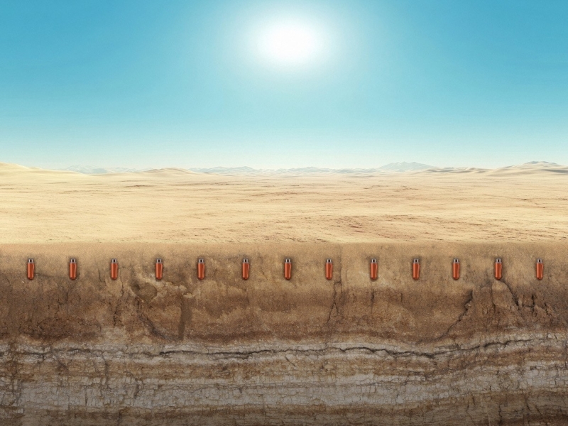
STRYDE is a specialist subsurface imaging solution provider, using their cutting-edge nodal seismic data acquisition system to help engineering teams acquire high-quality seismic data:
Quickly
At low cost
In challenging environments
With minimal disruption to site operations
We enable civil engineering teams to obtain decision-ready subsurface insights that reduce uncertainty and improve outcomes.
Civil engineering projects don’t happen on perfect open ground.
STRYDE’s system is designed for challenging conditions including:
Active construction sites
Remote infrastructure corridors
Urban and peri-urban environments
Harsh climates (heat, dust, cold)
High-noise ground conditions
STRYDE's low cost and lightweight system enables:
Dense receiver layouts
Rapid deployment
High productivity per crew
Scalable surveys from small sites to major corridors
Meaning you can capture more subsurface information in less time, improving the reliability of your ground model.
STRYDE surveys deliver outputs that integrate directly into engineering workflows, including:
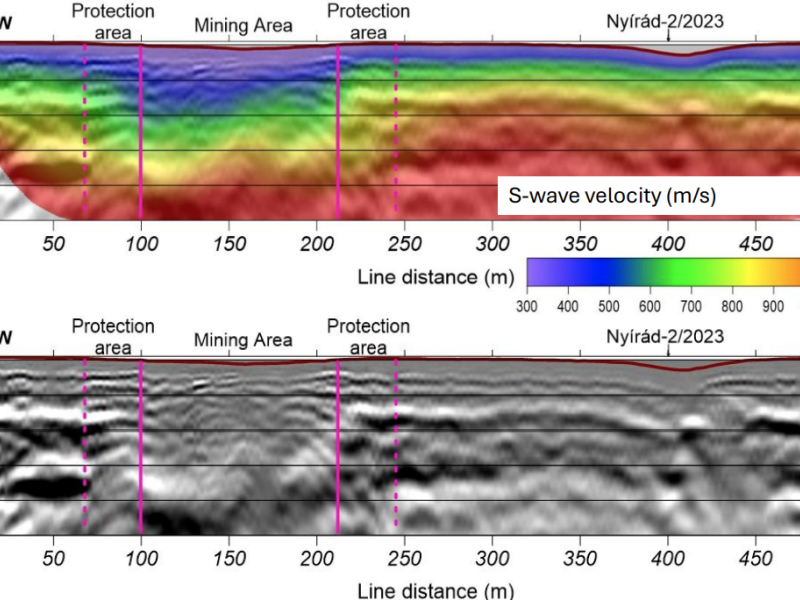
Rockhead depth maps
Weathering thickness maps
Vs profiles (MASW)
Fault and discontinuity interpretation
Hazard zone identification
The result? Fewer surprises. Better design. Reduced risk.
If you’re planning a major onshore civil engineering project and want to:
✅ Improve confidence in your ground model
✅ Reduce uncertainty between boreholes
✅ Identify hazards early
✅ Optimise investigation spend
✅ Avoid costly delays and redesign
Then high-resolution seismic should be part of your ground risk strategy. Get in touch with us to discuss more!