
Case study
A case study highlighting how STRYDE’s seismic technology was used to help advance a major carbon capture and storage (CCS) project in SE Texas - part of a wider initiative to decarbonize the Texas Gulf Coast’s industrial corridor.
The project is aimed at capturing and permanently storing carbon dioxide (CO₂) emissions from industrial sources.
bp is appraising, developing, and permitting the geological storage sites for permanent CO₂ sequestration.
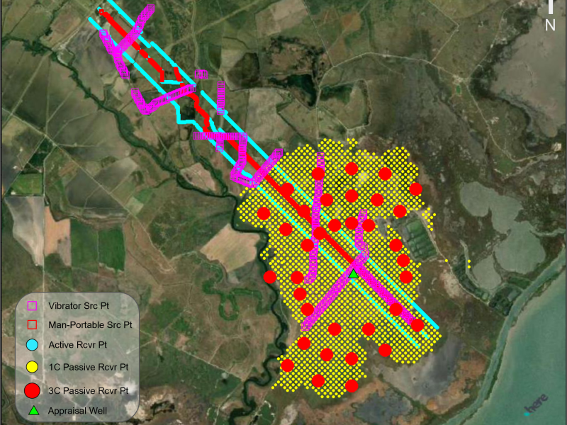
STRYDE’s Nimble Seismic System was deployed by seismic contractor, Explor, to acquire high-density passive and active seismic data, which bp's subsurface team used to enhance legacy fault interpretations and update both static and dynamic reservoir models - critical steps in advancing project development.
This project case study was built from the paper showcased at the EAGE Land Seismic Acquisition workshop in Calgary, 2025:
Naranjo, J., Joy, C. and Dootson, I. [2025] Getting the Right Amount of a Bit of Everything; Acquisition at BP’s West Bay Site, Texas, First EAGE Workshop Land Seismic Acquisition, 2025, 1-2. https://doi.org/10.3997/2214-4609.202580004
The survey area featured active "2.5D" seismic acquisition using a combination of source techniques, including vibroseis and Explor’s PinPoint man-portable source. In addition, both 1C and 3C passive seismic acquisition methods were deployed.
Coastal wetlands, prairie, and cultivated farmland. These natural landscapes are interspersed with developed areas, contributing to a complex working environment.
There are several potential carbon storage sites identified along the Texas Gulf Coast. While the region has extensive seismic data and numerous wells drilled for oil and gas exploration, most of this data targets deeper formations and lacks high-resolution logging of the shallower intervals where carbon storage is being considered. The primary objective of bp’s 2022 campaign was to drill an appraisal well and gather the subsurface and engineering data required to support a Class VI permit application to the U.S. EPA for potential carbon storage.
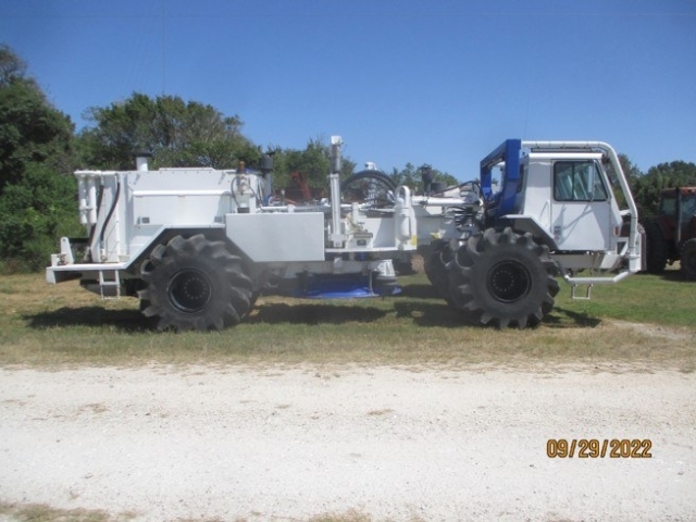
Two IVI Birdwagens were deployed, but due to landowner restrictions limiting access to heavy machinery roads, source coverage was irregular and insufficient for reliable 3D imaging. This prompted bp to consider alternative approaches, including the use of a man-portable seismic source to improve coverage under challenging surface conditions.
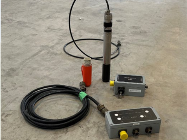
To operate in sensitive surface conditions and improve source coverage, the Explor PinPoint deflagrant man-portable source was used, with shallow holes drilled for better coupling. Each shot was timed and detonated via connected electronics, and a STRYDE node placed near each shot point served as an uphole calibration for shot timing.
A single man-portable source line was acquired down the center of the 3-line spread, laterally offset by 10 ft from node locations to avoid direct overlap. The median source spacing was 14.05 ft, with some deviations near pipelines and agricultural zones on the north end. Of the planned 2,600 shot points (SPs), 2,211 were acquired. Shooting efficiency averaged 150 SPs per day, with peak days reaching nearly double that, and occasional low-output days due to weather or technical issues.
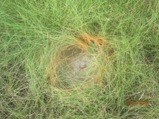
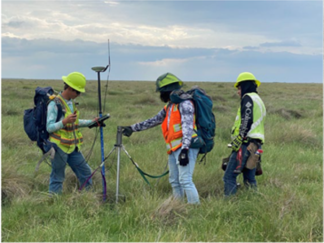
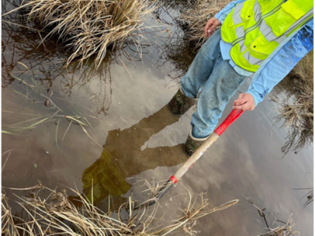
STRYDE nodes were deployed using stakeless surveying, with 2-person teams navigating directly to each receiver point. Nodes were drilled into the ground rather than spiked for better stability. With landowner permission, biodegradable paint was used to mark node locations, simplifying recovery. Despite being placed in active farmland, where fields were plowed, disked, and harvested, the nodes remained intact and operational throughout.
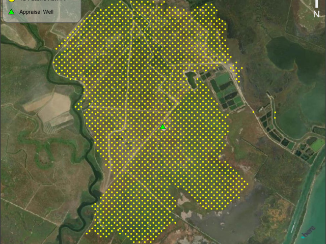
Three receiver lines were deployed at a 33 ft spacing to enhance imaging resolution. Most deviations from the preplot occurred near agricultural areas and pipelines on the north end. Despite planning for 3,100 nodes, about 100 stations were dropped due to factors like water level changes, wildlife, or human error, though nearly all were recovered. Three 2-person teams achieved an average deployment rate of nearly one node per minute, demonstrating efficient field operations.

node spacing
nodes deployed
two person teams
node deployed per minute
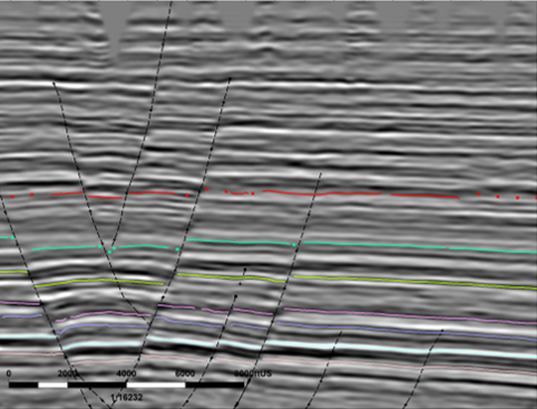
Legacy (left), new vibroseis data (right).
Seismic data owned or controlled by Seismic Exchange, Inc.; interpretation is that of bp.
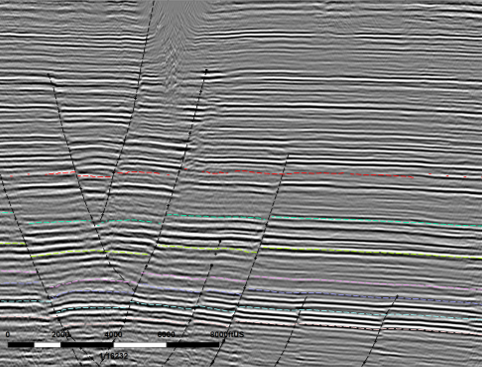
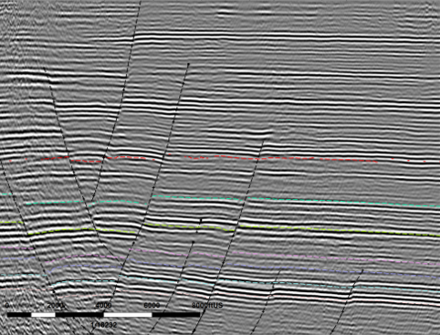
Vibroseis (left), PinPoint (right)
The final phase of data acquisition transitioned into passive monitoring. bp were particularly keen to collect passive seismic data over an extended period to characterize the background seismicity of the area prior to any injection activities.
The 4GB memory STRYDE nodes, which allows for up to 28 days of continuous recording at a 2ms sample rate, were used. The spacing array was approximately 1.5 times the well depth, and a preplot of receiver points centered around the wellhead was designed. There was also a specific interest in collecting passive data in both 1-component and 3-component configurations.
Notably, an injection test was conducted at the wellsite during the deployment phase of the passive array. While it wasn’t sufficient to fracture the formation, it did include perforations and other downhole activities that may have generated detectable seismic signals.
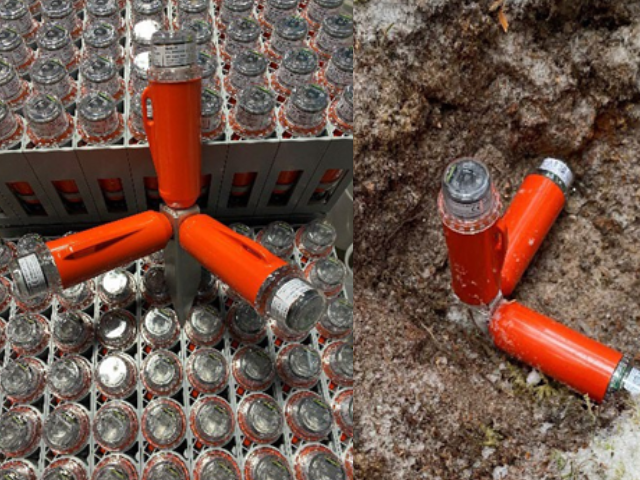
No additional receivers were required for 3C recording. Instead, bp utilized Explor’s patented 3C pins in combination with existing STRYDE nodes. While not originally part of the survey design, the STRYDE node is capable of recording in the horizontal domain when correctly coupled, an approach supported by published research.
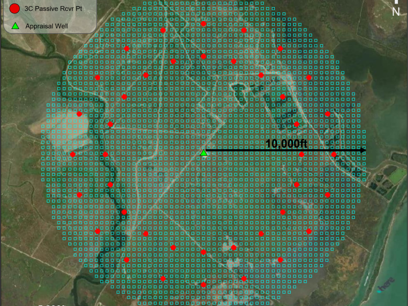
The original 1C preplot used a 300 x 300 ft receiver spacing, but several adjustments were made after field scouting. Receiver points were removed near sludge ponds and coastal standing water due to industrial use and access concerns. Deployment west of Chocolate Bayou was also cut after determining the terrain was too difficult to access. Additional locations in saturated areas to the south and east were excluded due to anticipated inaccessibility.
For the 3C node deployment, all 35 planned locations were successfully deployed and recovered. Notably, small teams of fewer than 10 people managed the full deployment and recovery, covering nearly 300 miles in total. According to the Explor Project Manager, this was a significant achievement, especially as site conditions worsened over time due to rising water levels.
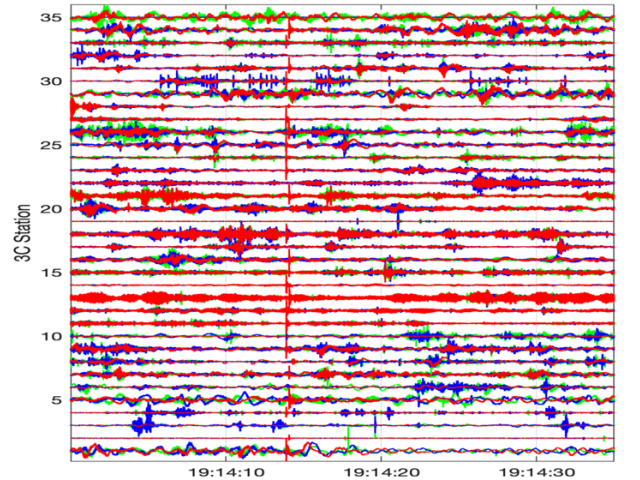
The passive data successfully confirmed background seismicity in the area. Analysis is ongoing through both University Consortia studies and internal efforts at bp. The example shown highlights a short time window of 3C data, with red traces representing the vertical component and blue and green showing the horizontal components, note the clear alignment of a seismic event just left of center.
The project was safely and efficiently executed, meeting both business and field objectives within a manageable cost framework.
The acquired seismic data proved to be of high quality, enabling the subsurface team to refine fault interpretations and enhance geological understanding.
This project reinforced the value of high data density. Greater spatial coverage translated directly into improved image resolution and subsurface clarity.
In areas where conventional sources were restricted due to surface conditions, the use of alternative sources, despite lower energy output, still delivered valuable geophysical results.