


Civil engineering
Case study:
Tailings dams can fail locally, making detailed spatial understanding essential for effective risk management. Traditional borehole investigations provide valuable but limited information, particularly when only a small number of sampling points are available.
High-density seismic acquisition offers a complementary method for understanding what lies between boreholes, helping operators and engineering teams identify potential areas of concern, validate existing assumptions, and make better-informed decisions about dam safety and monitoring.
In this project, STRYDE’s compact nodal technology enabled a dense, efficient survey across a challenging site, delivering the spatial resolution required to support confident geotechnical interpretation.
Provide engineering teams with higher-confidence subsurface insight to support dam stability assessment and risk-based decision-making.
Deploy a high-density seismic survey across the tailings dam to generate a high-resolution 3D shear wave velocity model of the dam and underlying geology.
The seismic survey was commissioned by Codelco, Chile’s state-owned copper mining company.
The 3D seismic survey was acquired by a leading international geo-data service provider, using the STRYDE seismic data acquisition system.
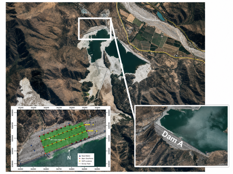
Mining operator, Codelco, in South America needed to assess the integrity of a large upstream-constructed tailings dam located in difficult terrain with challenging access conditions.
The dam was approximately 300+ metres wide and 80 metres high, making full spatial understanding of the structure critical. However, existing ground investigation data was limited to only five boreholes. While boreholes provide valuable point measurements, they leave significant uncertainty between sampling locations, particularly in complex engineered structures where localised weak zones can create material risk.
Codelco required a more complete understanding of the dam’s internal structure to determine whether weak materials were present and to support better-informed geotechnical risk assessment.
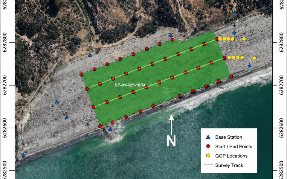
STRYDE nodes enabled a high-density seismic survey across the dam, using approximately 1,000 ultra-lightweight seismic nodes to capture subsurface data across the full structure.
The survey was completed in three weeks and combined Ambient Noise Tomography with MASW profiling to provide a detailed understanding of near-surface conditions.
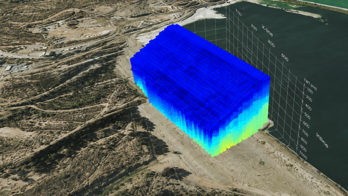
This approach enabled the creation of a high-resolution 3D shear wave velocity model, helping the client move beyond sparse borehole data and visualise the internal structure of the dam at metre-scale resolution.
The seismic data was used to interpret key geological and geotechnical features within and beneath the dam, including:
Statistical clustering techniques were also applied to automatically identify and visualise distinct subsurface zones. This helped transform complex geophysical data into clear, interpretable outputs for engineering and risk assessment teams.
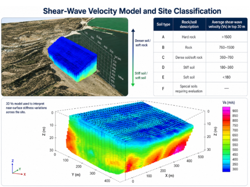
The survey found no significant weak zones within the dam structure.
The shear wave velocity results indicated consistently dense and competent materials across the investigated area, providing increased confidence in the dam’s condition despite the limited borehole coverage available at the start of the project.
The final 3D model enabled the client to visualise the dam structure, bedrock surface, weathered rock zones, and dense soil distribution in a way that was not possible from borehole data alone.
By deploying a dense array of compact seismic nodes, STRYDE's seismic technology helped Codelco fill critical information gaps between sparse boreholes and gain a more complete understanding of the dam’s subsurface condition.
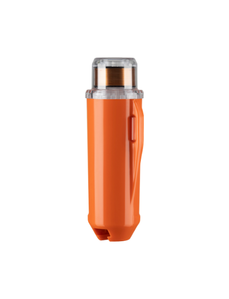
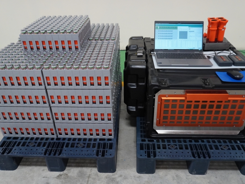
The STRYDE Mini System enabled a compact, efficient, high-resolution seismic investigation that helped turn sparse point-based borehole information into a more complete 3D understanding of the tailings dam structure.
The STRYDE nodes enabled high-density seismic data to be acquired across the dam structure over a period of around three weeks. Its small, lightweight nodes made deployment practical in difficult terrain and helped the team achieve the spatial coverage needed to investigate conditions between the five available boreholes.
For this application, the Mini System provided a practical way to collect Ambient Noise Tomography data, supplemented by MASW profiling, to build a high-resolution 3D shear wave velocity model. This allowed the client to visualise changes in material stiffness across the dam, including dense soils, weathered rock, and bedrock, and to assess whether any significant weak zones were present.